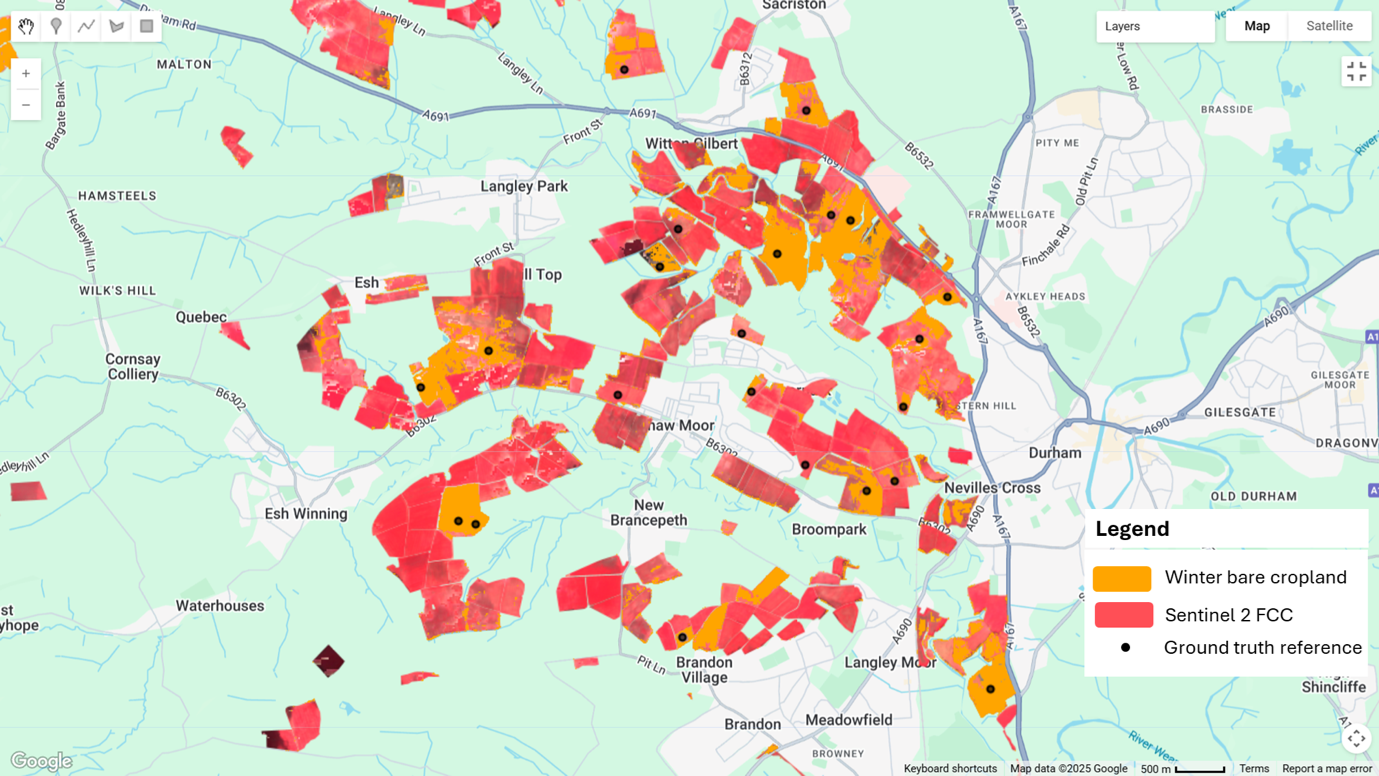


As part of River Deep Mountain AI, we are now releasing the first open source remote-sensing model capable of detecting bare winter cropland, which represent potential sources of pollution in river catchments.
In England, agriculture is one of many sources of pollution impacting water quality. For instance, around 60% of nitrate, 25% of phosphorus and 75% of sediment in water bodies is estimated to originate from agriculture1. These pollutants, together with others, contribute to the fact that only 14% of water bodies in England meet the “good ecological status” defined by the Water Framework Directive.
When assessing the pollution risk of a river catchment, it’s often necessary to do walkovers next to the river to detect areas with increased run-off risks. These walkovers are time-consuming, inefficient and ideally need to be undertaken during wet weather to give an accurate understanding of potential risks.
To try and help reduce the financial costs associated with time-consuming walkovers, we are developing several remote sensing-based models utilising computer vision and satellite imagery to detect potential sources of pollution. Now we are releasing the first one, focused on detecting bare croplands.
These models will help enable catchment managers and other stakeholders, to quickly pinpoint some of the potential sources of pollution within a catchment, and conduct targeted investigations.
Detecting bare cropland
Bare cropland detection is useful for identifying areas with greater runoff risk, where pollutants like fertilisers, pesticides, and sediment are more likely to be transported into nearby water bodies during periods of rainfall. Identifying bare cropland can assist in pinpointing potential pollution hotspots and implementing targeted measures to mitigate water contamination.